
The Seine is a major river of North Western France and one of its well-known commercial waterways, plus a great tourist attraction, especially within the city of Paris.
Dating back to when the Parisii tribe first established a fishing village along its banks, the waters of the River Seine have always been the heart and soul of Paris.
445km from its mouth, the River Seine is only around 24m above sea level and the average depth is only around 8m in Paris, which also makes it slow flowing and easily navigable.
From Le Havre, the tidal section of the river goes to well beyond Rouen and ocean-going vessels can get 120km down from the sea to Rouen where they can dock. The River Seine is dredged and commercial riverboats can use the river for 560km from its mouth.
Beyond Rouen there is a section that has 4 large multiple locks until the mouth of the River Oise. There are 2 more locks and at Suresnes this lifts the vessels to the level of the River Seine in Paris, which is where the River Marne is located.
Until locks were installed in the 1800's to artificially raise the levels of the this river, the levels did fluctuate, but today, the depth is tightly controlled and the entire width of the river between the built-up banks on either side is normally filled with water.
When Paris prospered through extensive river trading and expanded to the Left Bank in the days of the Roman Empire, the Seine became a great commercial artery, which was linked by canals to the River Loire, River Rhine, and the River Rhone.
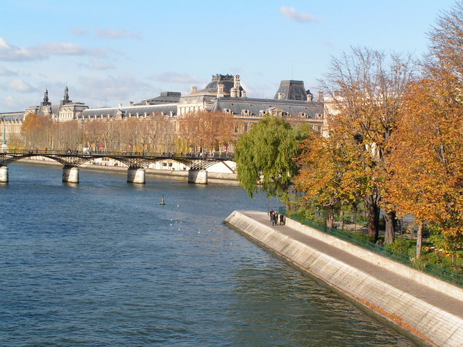
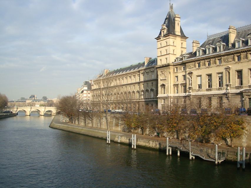
Tourists and travellers will notice the many splendid bridges, which span the River Seine, some of them several centuries old, and the oldest of these is the Pont-Neuf, whose first stone was laid in 1578 by Henri III in the presence of the Queen Mother, Catherine de Medicis.
The newest bridge called the Pont Charles de Gaulle was completed in the summer of 1996 to accommodate the ever-increasing influx of traffic, especially with the new stadium.
The Seine, is without a doubt the best-known French river in France and travels from Dijon in the Alps, through to Paris, which it cuts in half, and then onto Le Havre, where it meets the English Channel.
This divide by the River Seine through Paris is what gives the city its distinct, geographic division. For instance, the Eiffel Tower and the Musee d'Orsay are on the south bank, whilst the Louvre, Grand Palais, and the Concorde can be found on the north bank. In the centre of Paris on the Ile de la Cite in the middle of the Seine River, you will find the Notre Dame Cathedral among other monuments.
And where the river forks in the centre of Paris it creates two small islands, which are called the Ile de la Cite and the Ile Saint-Louis, also the River Seine is one of Europe's great historical rivers, that attract tourists from all around the world.
Beyond Rouen there is a section that has 4 large multiple locks until the mouth of the River Oise. There are 2 more locks and at Suresnes this lifts the vessels to the level of the River Seine in Paris, which is where the River Marne is located.
Until locks were installed in the 1800's to artificially raise the levels of the this river, the levels did fluctuate, but today, the depth is tightly controlled and the entire width of the river between the built-up banks on either side is normally filled with water.
When Paris prospered through extensive river trading and expanded to the Left Bank in the days of the Roman Empire, the Seine became a great commercial artery, which was linked by canals to the River Loire, River Rhine, and the River Rhone.
Tourists and travellers will notice the many splendid bridges, which span the River Seine, some of them several centuries old, and the oldest of these is the Pont-Neuf, whose first stone was laid in 1578 by Henri III in the presence of the Queen Mother, Catherine de Medicis.
The newest bridge called the Pont Charles de Gaulle was completed in the summer of 1996 to accommodate the ever-increasing influx of traffic, especially with the new stadium.
The Seine, is without a doubt the best-known French river in France and travels from Dijon in the Alps, through to Paris, which it cuts in half, and then onto Le Havre, where it meets the English Channel.
This divide by the River Seine through Paris is what gives the city its distinct, geographic division. For instance, the Eiffel Tower and the Musee d'Orsay are on the south bank, whilst the Louvre, Grand Palais, and the Concorde can be found on the north bank. In the centre of Paris on the Ile de la Cite in the middle of the Seine River, you will find the Notre Dame Cathedral among other monuments.
And where the river forks in the centre of Paris it creates two small islands, which are called the Ile de la Cite and the Ile Saint-Louis, also the River Seine is one of Europe's great historical rivers, that attract tourists from all around the world.
While it's common knowledge that the Notre Dame Cathedral is the technical epicenter of Paris, the real essence of the city is captured by the river Seine.
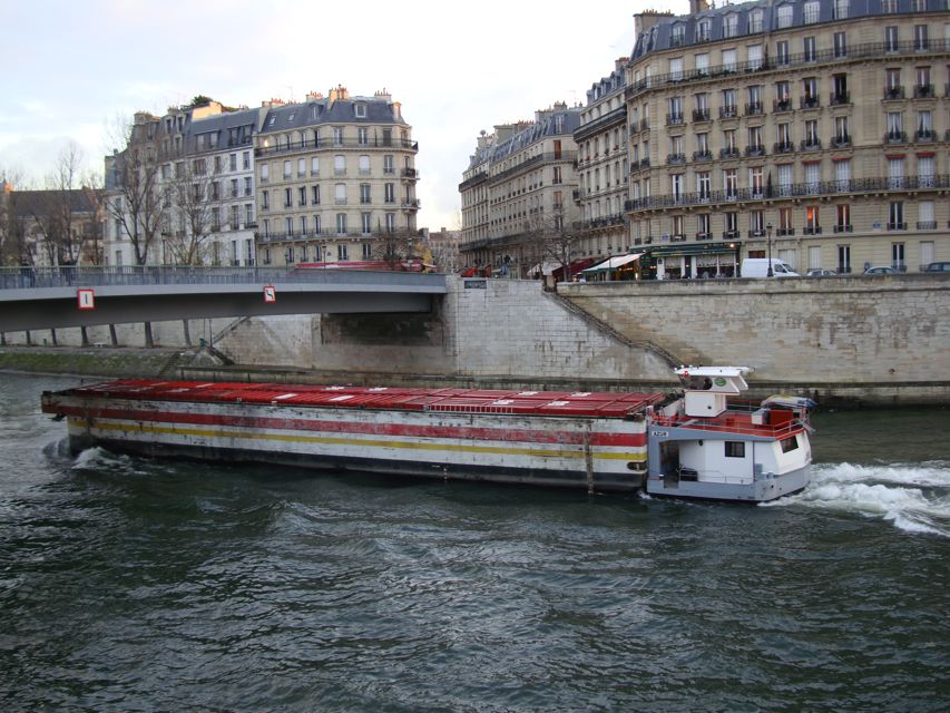
Almost any city situated near water is changed by that relationship between the static and the constantly moving. On a metaphysical level, the water is a type of mirror in which the city finds its own reflection. For centuries, poets, painters, philosophers, novelists, architects, lovers, suicides, and finally, tourists, have understood this powerful attraction. The river Seine flows right through the heart of Paris bordering 10 of the 20 arrondisements. It was no accident that the city evolved around this gigantic avenue for commerce and transportation, or that the early Parisi tribes on the river's island were attacked and overthrown by the Romans. This early coup took place on what was later to become some very prime real estate. At that time the river was called by it's Latin name: Sequana. The river is still the chief commercial waterway and half of the water used in Paris still comes form the Seine. Don't think about that when you look at the sick green water flowing under the bridge, or when your waiter brings you a glass of tap water.
Tourists are often confused about the terms "right bank" and "left bank" and spend hours on street corners with crumpled maps trying to orient themselves and figure out which side of the riverbank they are standing on. The system is very simple and was devised because the river's curvy nature often does make orientation difficult. The trick is to remember when you face DOWNRIVER the left bank is on your left and the right bank is on your right. If you can't tell left from right at this point you should not be traveling alone. If you can't figure out which way the water is flowing (don't look at the boats, they go upstream too!) drop a potato chip or look for some debris and see which way it's floating. Then you will be able to make it to the Café Les Deux Magots on time, and not end up at La Defense.
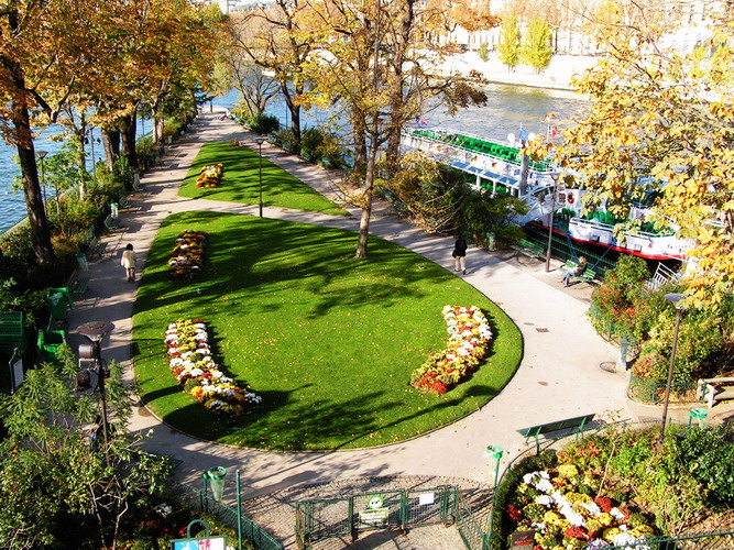
There are 32 bridges on the river in Paris, some of them more impressive than others. The Oldest bridge is the Pont Neuf which has been immortalized by artists and poets and even 20th century films. (see The Lovers of the Pont Neuf) There is a beautiful little island crossed by the bridge which the riverboat tours now use as a docking station. In the spring or summer it's a wonderful place to hang out on a bench under the willow trees, or sunbathe on the slanted stone embankments near the tended gardens in its center. To get there, simply make your way toward the equestrian statue of Henri V and find the steps leading down toward the docks. If you are the kind of person who likes watching boats this is a great spot. Actually it is one of the nicest places to hang out in all of Paris.
No comments:
Post a Comment